MAP LEGEND:  
Section Length: 6.8 Trail Authority: North Country National Scenic Trail Association and the Superior Hiking Trail Association
Trail Surface: Natural Campsites along this section: 2
Trail Start/End Points: Martin Road Trailhead. Lismore Road. Towns/Cities along this Trail section: None
Trail Type: Long Distance Hiking Trail Trail Related Websites: Superior Hiking Trail Association and North Country Trail Association
Trail Uses: Hiking Section Last Visited: 05/03/2020

Superior Hiking Trail - Martin Road Trailhead to Lismore Road

Description

A mostly easy going, flat section with the trail meandering through woodlands. Follows snowmobile trail for several miles. Crosses small creeks and the Lester River.


Trail Connections

Superior Hiking Trail - Hartley Nature Center TH to Martin Road TR (southbound)
Superior Hiking Trail - Lismore Road to Normanna Road TH (northbound)


Trail Access/Parking

Martin Road Trailhead parking lot
Lismore Road (on side of the road, no parking lot or trailhead here)


Restrooms/Water Available

Restroom at Martin Road Trailhead.


Campsites in this Section: Two

Bald Eagle Campsite
White Pine Campsite


Scenic Overlook Spur Trails in this Section: One

Wetland Overlook


Realtime Section Video (hiked south to north)
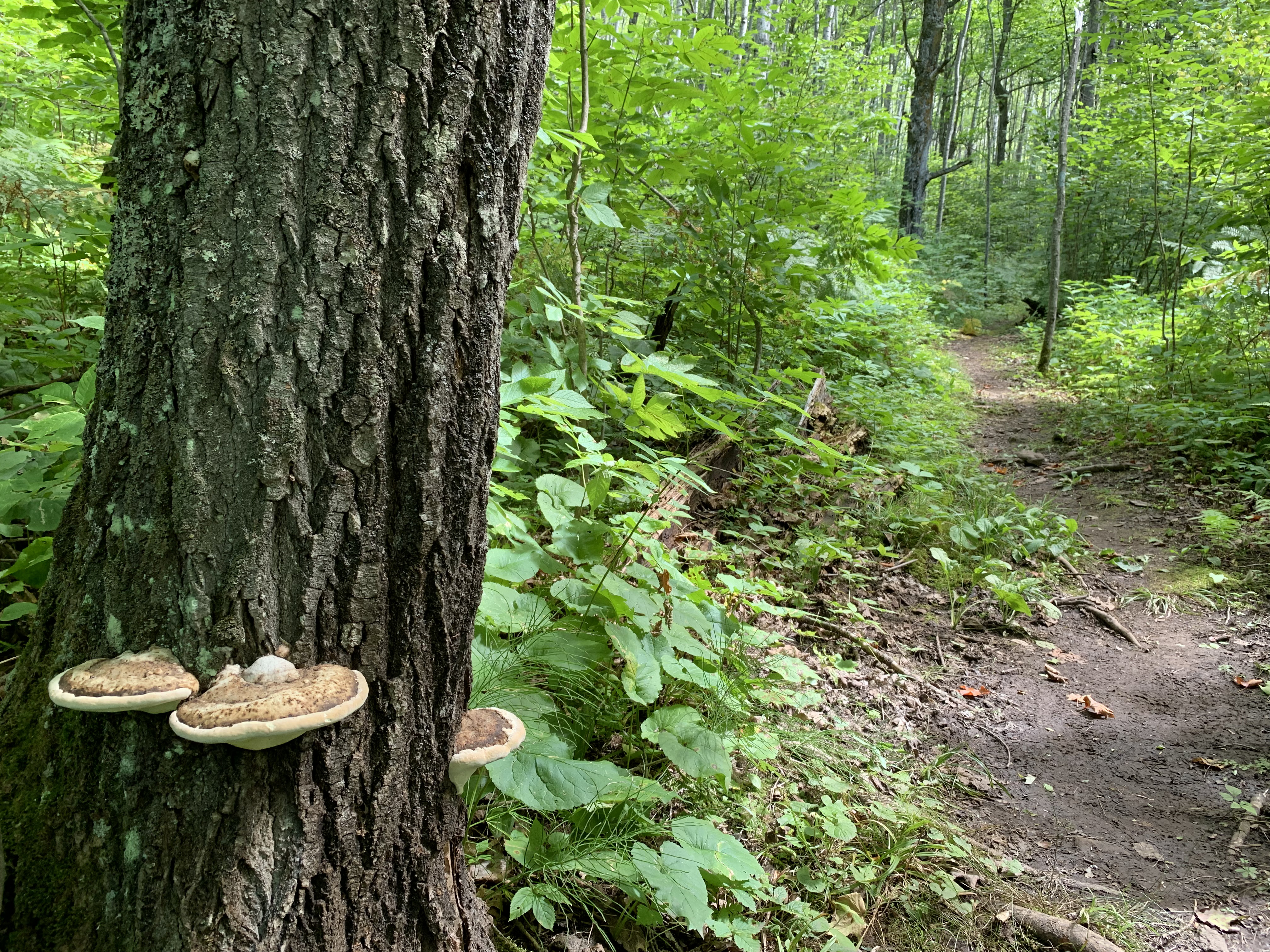

Hiking from the Martin Road Trailhead to Lismore Road. This is 6.8 miles.


This Section - Mile by Mile

Click on the photos below to see the full resolution image - Use your browsers back button to close photo and return to this page.

Mile 0.6 (section) Mile 50.8 (SHT): East Branch of Amity Creek.

This is a small creek hidden in the grass and bushes.

Mile 2.4 (section) Mile 52.6 (SHT): Near Prindle Road.

View of the SHT just north of Prindle Road.

Mile 3.5 (section) Mile 53.7 (SHT): Fungus growing on a tree.

View along the SHT.


One of several plank walkways along this section.

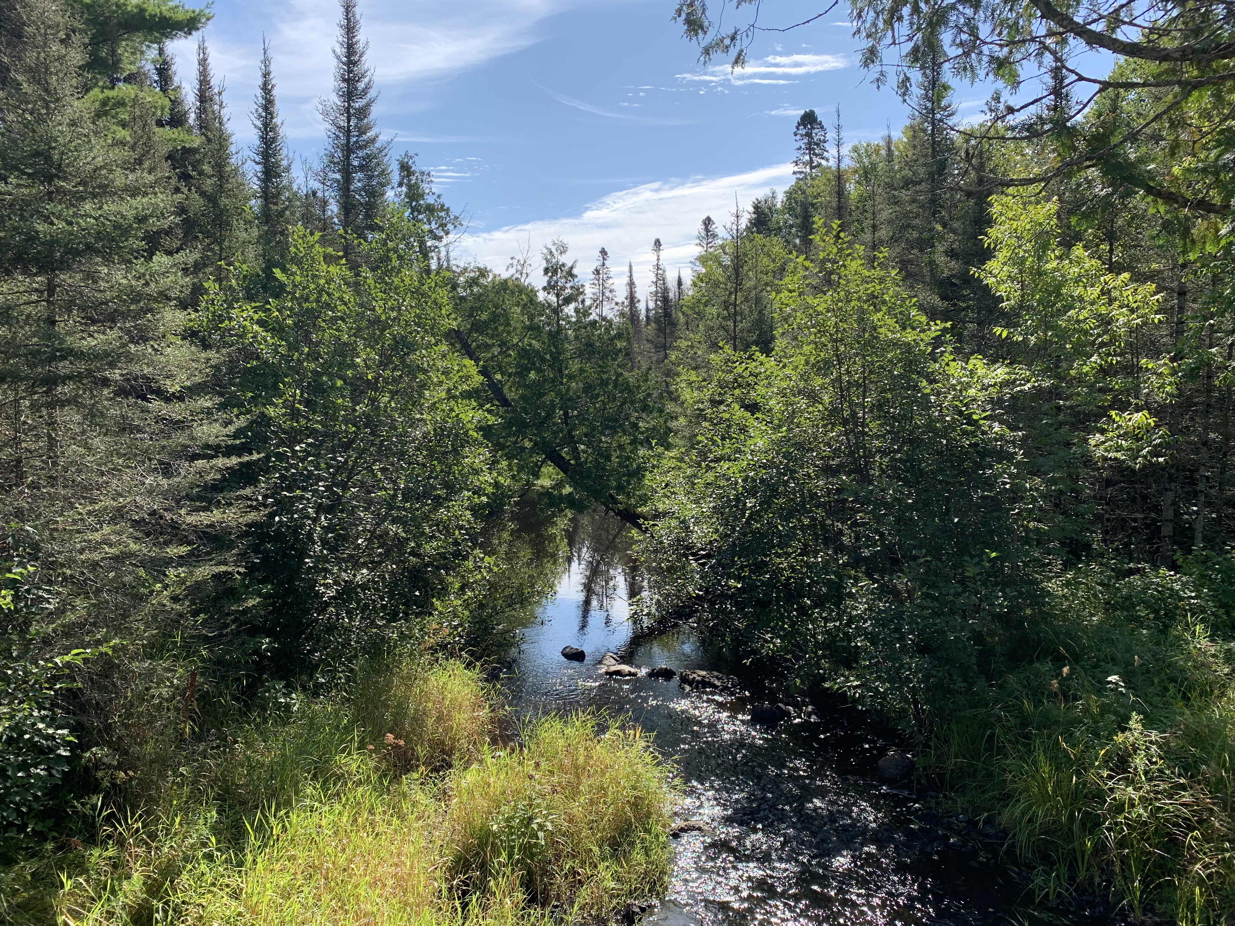
Mile 3.8 (section) Mile 54.0 (SHT): Junction with the Wetland Spur Trail.

Short spur trail that leads to a fine view of a wetland and pond.

Mile 4.3 (section) Mile 54.5 (SHT): Woodland Scene.

View upriver from the Red River bridge.

Mile 4.9 (section) Mile 55.1 (SHT): Bald Eagle Campsite.

Passing the Bald Eagle Campsite.

Mile 6.0 (section) Mile 56.2 (SHT): White Pine Campsite.

The White Pine Campsite is located along the Lester River.

Mile 6.1 (section) Mile 56.3 (SHT): Lester River Crossing.

View from the little bridge over the Lester River.

Mile 6.8 (section) Mile 57.0 (SHT): Lismore Road.

Arrival at Lismore Road. From here the trail follows the road for a ways to the east.

Continue hiking next section of the SHT: Lismore Road to Normanna Road TH


Disclaimer Privacy Policy Contact Us About Us
- www.MidwestTrails.com - All Rights Reserved. All images, videos and text property of MidwestTrails.com - No reuse without permission.