 |
|
|||||||||||||
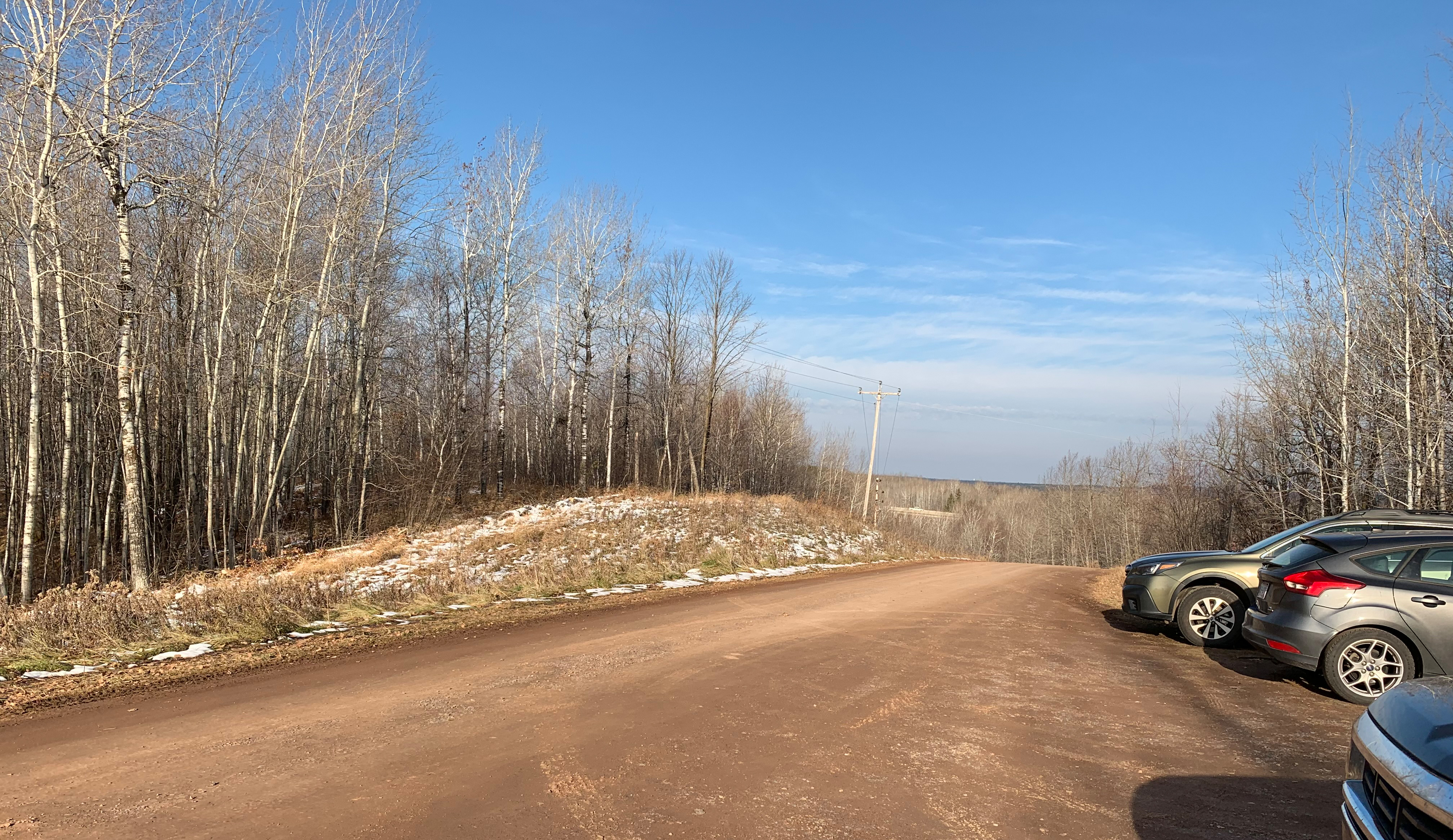
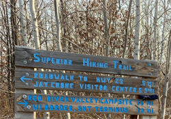
Superior Hiking Trail - MN/WI Border to Wild Valley Road TrailheadDescriptionShort hilly section that runs from the Wild Valley Road trailhead to the Minnesota/Wisconsin border. The border marks the southern terminus of the Superior Hiking Trail. This is an out and back hike. Note that you can continue hiking into Wisconsin along the North Country National Scenic Trail. The connection between the Superior Hiking Trail and the North Country National Scenic Trail (NCST) was recently created (as of about 2019) allowing for continuation into Wisconsin. Trail ConnectionsNorth Country National Scenic Trail Trail Access/ParkingWild Valley Road. The trailhead parking lot is about 1,800 feet up Wild Valley Road from Minnesota Highway 23. Wild Valley Road is hilly and has a gravel surface. Restrooms/Water AvailableNo restroom or water at the Wild Valley Road trailhead. Water can be filtered from the Red River, which is crossed near this sections only campsite. Campsites in this Section: OneScenic Overlook Spur Trails in this SectionRed River Bridge Realtime Section Video (hiked south to north)
This Section - Mile by MileClick on the photos below to see the full resolution image - Use your browsers back button to close photo and return to this page. Mile 0.0 (section) Mile 0.0 (SHT): Southern terminus of the Superior Hiking Trail.
Mile 0.2 (section) Mile 0.2 (SHT): Red River bridge crossing.
Mile 0.3 (section) Mile 0.3 (SHT): Red River Valley Campsite. Mile 1.1 (section) Mile 1.1 (SHT): Wild Valley Road crossing. Mile 1.9 (section) Mile 1.9 (SHT): Wild Valley Road Trailhead and Parking Lot.
Continue hiking next section of the SHT: Wild Valley Road TH to Jay Cooke State Park Visitor Center |
||||||||||||||